Over the last year, Greenspace information for Greater London (GiGL) has been working towards launching a brand new habitat database that covers the whole Greater London area.
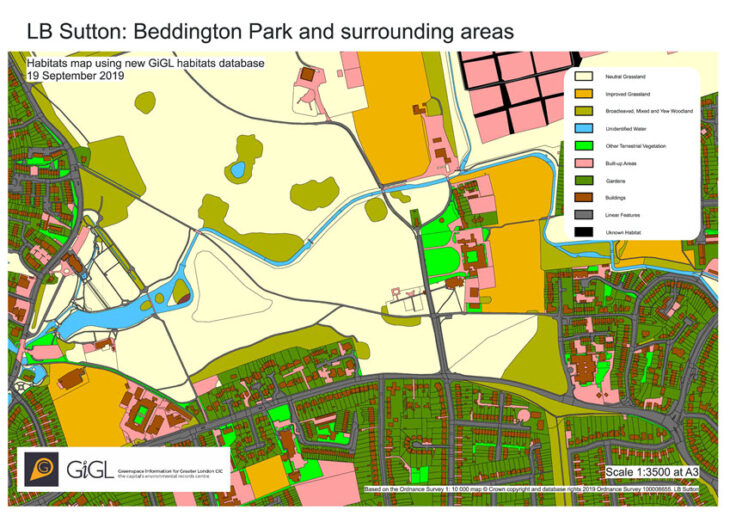
The new GiGL habitat database incorporates the legacy of information from London’s rolling borough-by-borough habitat survey (1984-2008), subsequent local surveys, and Ordnance Survey’s (OS) land use data. All of this information was translated into the hierarchical Integrated Habitat System (IHS) and is aggregated within an OS MasterMap-based framework, and includes additional information about topology, data sources and priority habitats. What makes this hierarchical system special is that it allows the incorporation of data based on a range of standard survey methodologies such as Phase 1 and the National Vegetation Classification (NVC), and also enables the export of habitat data as IHS classes, broad habitat types or priority habitats, for any area of interest.
What are the benefits?
Because the new database is grounded within an OS MasterMap framework it provides contiguous coverage across the whole of London, allowing any gaps about habitat and land use between the more detailed legacy habitat survey data to be filled in. The flexibility and coverage of this new database will provide greater opportunities to better monitor, understand and improve knowledge of the landscape. Ultimately, it has the potential to revolutionise the ways in which the natural environment in London can be studied.
The database will also “establish a cost-effective monitoring framework, to ensure important natural environment data is collected consistently”, as proposed by The Mayor in the London Environmental Strategy (p.189).
One of the perks of this new database is that the data can be easily translated into other habitat classifications, such as the new UK Habitat Classification, and into metrics useful for different users and audiences, making it particularly useful for work relating to Biodiversity Net Gain. GiGL, as an accredited Local Environmental Record Centre, will have a key role in providing data and information services for different stages of biodiversity net gain delivery across London. The new habitat database will also be particularly useful for calculating metrics, and setting context about the importance of the natural environment through ecological network mapping and the assessment of natural capital and ecosystem services.
Who can access this information?
The database is currently a beta version but once released, the data will be available under the same terms as other GiGL core datasets. The actual GIS data will be available only for its Service Level Agreement (SLA) partners, but the information will be displayed as part of GiGL data search reports. The data will also be available for anyone who is interested in conducting habitat-related studies in London, under the appropriate licence agreement.