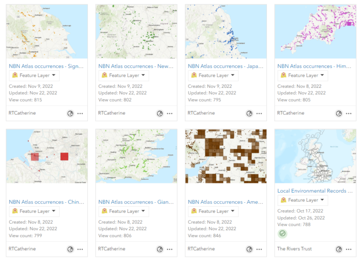
The Rivers Trust has recently used the NBN Atlas API to publish selected invasive species occurrence data to ArcGIS online. These datasets are available on the ArcGIS Online platform as publicly accessible layers and can be explored here.
The Rivers Trust used the NBN Atlas’ API to publish maps of occurrence records for several species which are of a particular issue in the conservation of freshwater. Occurrence data for the following species have been added as ArcGIS Online layers to date, but more may be added in future:
- American Mink Neovison vison
- Chinese Mitten Crab Eriocheir sinensis
- Giant Hogweed Heracleum mantegazzianum
- Himalayan Balsam Impatiens glandulifera
- Japanese Knotweed Fallopia japonica
- New Zealand Pigmyweed Crassula helmsii
- Signal Crayfish Pacifastacus leniusculus
Occurrence locations are indicated by polygons, with the size of the polygon relating to the ‘Coordinate uncertainty in metres’ provided by the NBN Atlas for each record. The data has also been spatially joined to the CaBA (Catchment Based Approach) catchment boundaries to allow the species data to be easily filtered to local catchment areas.
The Rivers Trust worked with the NBN Atlas data team to ensure that the data was correctly displayed and documented on ArcGIS Online. As such, the data published to ArcGIS Online has been filtered to exclude all CC-BY-NC licensed records as these records cannot be used for commercial purposes without prior agreement of the data provider. These additional excluded records may be available by contacting the local environmental records centre or the NBN Atlas. The contact details for local environmental records centres have been included in an additional ArcGIS Online layer. Any records without latitude and longitude coordinates and those records lacking coordinate uncertainty were also removed from the layers published to ArcGIS Online. As required by the NBN Atlas, all data providers are acknowledged in the pop-up for each occurrence polygon and a NBN Atlas link has been provided on the ArcGIS Online item details page which documents the full list of data providers for each species occurrence dataset.

Publishing this selected invasive species data to ArcGIS online will allow the NBN Atlas species data to be easily combined with other spatial datasets regularly used in freshwater conservation. This will allow practitioners to build up a more accurate picture of the pressures impacting a catchment.
If you have any questions, please contact data@theriverstrust.org