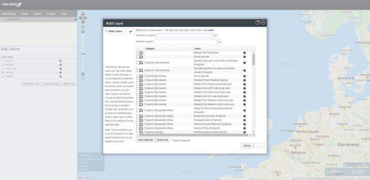
Apart from holding species data, the NBN Atlas can also hold spatial data layers such as boundary, habitat and environmental data layers. These spatial layers provide the background information that enables the selection of species records by specific features, such as protected areas.
Recently added layers:
- Belfast Hills Partnership boundary
- Burial grounds (selected) (England)
- District Council Boundaries (Northern Ireland)
- National Forest Estate boundaries (England)
- Network Rail’s regional route study areas
- Water Framework Directive River Basin Districts and Sub-Basin Districts (Scotland)
Recently updated layers:
- Marine Conservation Zones (England)
- Marine Protected Areas, SACs and SPAs (for Scotland)
The full set of spatial layers can be accessed through the NBN Atlas spatial portal. Navigate to the spatial portal from the NBN Atlas home page by selecting the ‘Analyse’ tab. Go to the ‘Add to Map’ dropdown in the top left corner and choose ‘Layers’ to reach the ‘Add Layer’ dialogue box. Layers are categorised by country and broad topic, and the metadata can be reached via the information (i) button alongside each layer name.