Written by Caroline Coleman & Lucy Lush, Thames Valley Environmental Records Centre
How would you know where to find different grasslands or other habitats such as ponds or traditional orchards in Oxfordshire? Many of us have local knowledge about favourite patches or places we’ve seen when we are out and about. And there are also sites that have been chosen for their importance to wildlife – Local Wildlife Sites, Conservation Target Areas and national designated sites such as SSSIs. Amazingly, though, there isn’t a comprehensive map showing habitat types across all of Oxfordshire.
Oxfordshire County Council has decided to remedy this and has commissioned Thames Valley Environmental Records Centre (TVERC) to map habitats across the whole of the county. This will prove invaluable for strategic decisions about where to prioritise conservation. It will also provide the information about the most important habitats for district and county planners when individual planning applications are received.
We have already carried out a similar project for Cherwell District Council. Some areas of high ecological importance were mapped for the first time and we also found some unexpected areas of interesting fen and grassland. This has demonstrated the value of producing a comprehensive habitat map.
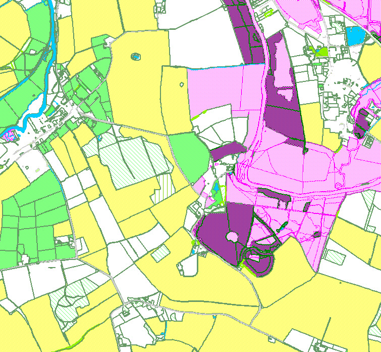
Although it would be lovely to spend the next few summers recording habitats across Oxfordshire, this isn’t the most efficient approach. Instead, we take advantage of aerial photography (and other sources) to take a bird’s eye view, identifying habitats as accurately as we can and then adding them to a GIS layer in MapInfo. Boundaries are based on Ordnance Survey Mastermap polygons. Although aerial photographs are our main source of information, we can also refer to other data. For example, we have previous field survey records for some habitats and we can also refer to existing datasets, such as mapping for Farm Environment Plans, or the National Inventory of Woodland and Trees.
The updated GIS layer is made available to all of TVERC’s funding partners, including local authorities, BBOWT, Natural England and the Environment Agency. We also provide tailored habitat data to others through data search requests, which normally cover a defined area.
So far, we have made a start with mapping arable fields and grassland. It is rarely possible to be absolutely certain about some habitats – for example, distinguishing unimproved from improved grassland is tricky. Fortunately, Integrated Habitat System (IHS) codes allow us to use terms such as “probably improved” or “possibly unimproved”, reflecting the inherent uncertainty in identification from aerial photos. We also classify priority habitats of principal importance (as defined in the NERC Act S41) and Phase 1 habitat types. Other attributes are assigned following a methodology agreed within the South East Local Environmental Records Centre region, including information about how the habitat type was determined, data sources and the level of confidence. These attributes are essential for users to understand and interpret the data accurately, so they are always described in a metadata document provided alongside the GIS data.
This is a long-term project that will progress from the more straightforward habitats such as arable to more complex ones such as parkland. Over time, we will have a much better picture of Oxfordshire’s habitats and where they are.

