Integrating a 200 year-old record scheme into the 21st Century
written by Joseph Butler
Allow me to steal you for a minute and picture this: you're walking along the shore. You may be there in your keep-warm clothes, simply for a walk in the bracing sea air, or for something more focused; involving an arsenal of nondescript scientific tools. At some point along your excursion, curiosity causes you to examine a damp, algae-covered stone lying on the exposed shore. Lifting it, you discover a small, hard-shelled being sat in a crevice, equally as surprised to see you. It may be that said animal is utterly expected to be there, you see them on nearly every pass, or it may be that it's something new. Either way, you decide to make a note of it, and pass it on to someone who can take it further. The gradual accumulation of these sightings, both coincidental and intentional, builds a network of data detailing the location and abundance of the group known as the Brachyura (or the 'True Crabs,' to those who prefer a more descriptive term). Problems arise, however, when these events are detailed and logged under different authorities and in innumerable different places.
In 1973, an initiative was undertaken by Dr Ray W. Ingle of the British Museum, in conjunction with the Biological Records Centre, to collate records from these scattered depositories into a single entity. Sources included scientific literature, specimens held in institutions, collections held at the Natural History Museum and from record cards turned in by individual recorders. The end result was a single distribution atlas of brachyuran crabs occurring in the waters surrounding the British Isles; or the 'Crab Atlas,' as it has come to be known. The series, running from 1817 until 1983, involves over 11,200 records spanning 69 species of brachyuran crab in 41 genera, ranging from the Common Shore Crab (Carcinus maenas) to rarer, deeper species such as the Sargassum Crab (Planes minutus), and covering the North East Atlantic, including the British Isles, Ireland, and up to the Norwegian Seas. Each individual recording was written on a record card and filed for later reference and archiving. Unfortunately, as data holdings migrated into digital formats, the paper scripts remained as they were; in cardboard boxes in a fire-proof cabinet at the Marine Biological Association of the UK (MBA).
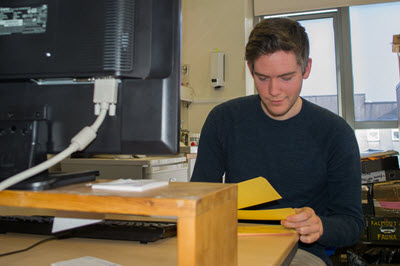
In 2014, funding was received through the NBN Data Capture Initiative to properly convert the entirety of the Crab Atlas by the data management experts within the DASSH team (Archive for Marine Species and Habitats Data) at the MBA. Digitisation of the record cards involved inputting each card into a standardised MEDIN format, a standard data configuration adopted worldwide, before integrating them into a single database. Previous experience in primary data translation meant that the task was not a daunting one, although problems arose surrounding the occasional vague location description or ambiguous handwriting, making it challenge to accurately determine details. In February 2015, the entirety of the record collection had been put into electronic form and quality assured to the high DASSH standards.

Records of ubiquitous groups such as crabs are particularly useful for indicating biogeographic areas around Britain and Ireland, which is becoming more apparent as we discover more non-native and potentially invasive species that could be harmful to the UK’s native species and habitats. Such examples include the Chinese Mitten Crab (Eriocheir sinensis), and the very recently found Japanese Shore Crab (Hemigrapsus sanguineus) on UK shores. Accurate distributions of crab species are also heavily sought after in order to understand how crab species are being affected by climate change, as well as what impacts non-native and/or invasive species will have on them, both ecologically and economically, at a variety of spatial scales.
The complete dataset is now moving forward to being publically available through the DASSH Data Archive Centre, the NBN Gateway and data.gov.uk for anyone wishing to use it. The metadata for the dataset will also be made available through the MEDIN Discovery portal.
We would like to thank the NBN Trust for providing the funding to digitise this important dataset and Paul Clark who provided the record cards and who originally compiled the ‘North East Atlantic Crab Atlas’ which was published by the Marine Conservation Society and supported by the Nature Conservancy Council and British Petroleum International Ltd.
